Log in
All resources
Create a design
33,884 Free Images of 1764 Maps
maps made in the 17th century
gerard valck
maps by pieter schenk (i)
atlantis magni tomus tertius (biblioteca comunale di trento)
atlas de wit 1698
fonds ancely - bibliothèque municipale de toulouse - maps
atlantis magni tomus secundus (biblioteca comunale di trento)
frederick de wit
maps from the mechanical curator collection
maps by willem and johannes blaeu
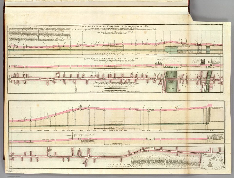
seine river in paris
old submaps of paris
maps from the mechanical curator collection
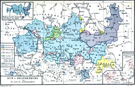
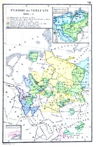
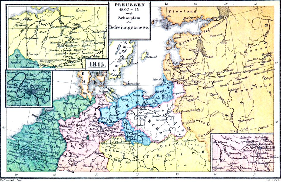
old maps of prussia
maps from the mechanical curator collection
old maps of prussia
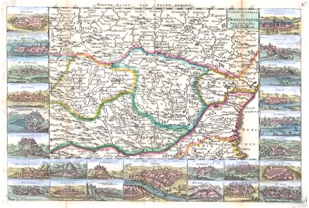
old maps of the danube
french-language maps
orfeo ed euridice
noël le mire
19th-century satirical maps
1899 maps of europe
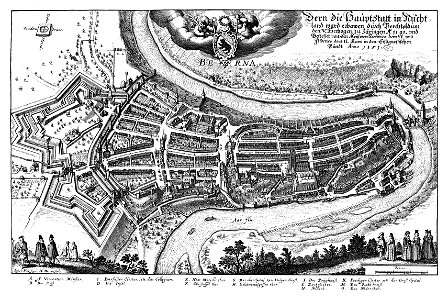
1638 in switzerland
bern
images from the new york public library
george hayward
maps from the mechanical curator collection
old maps of prussia
maps by willem and johannes blaeu
ravelins
cornell university library
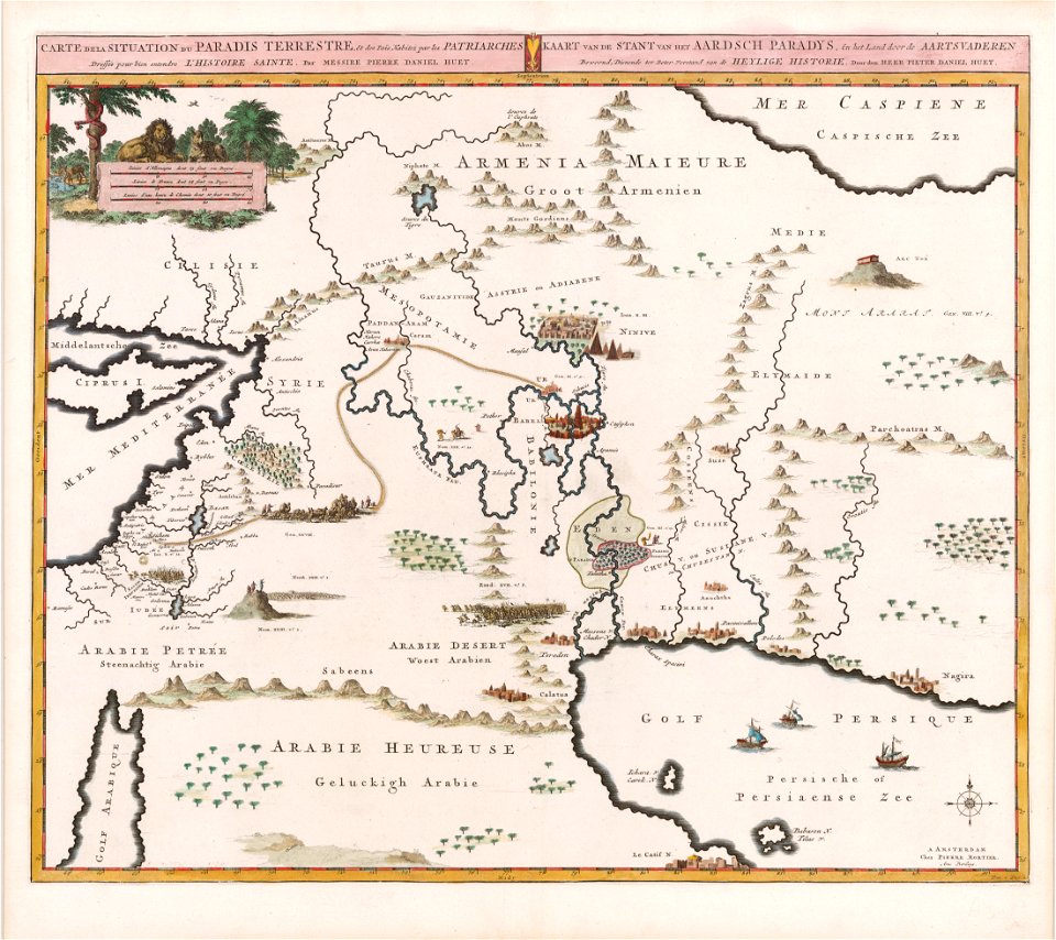
garden of eden
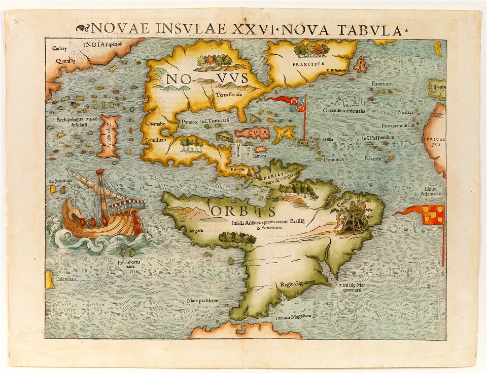
christopher columbus
ferdinand magellan
frédéric-auguste laguillermie
coats of arms of orléans
maps made in the 17th century
gerard valck
maps in the national archives of japan
genroku kuniezu
coats of arms of cities in corrèze
guillaume marie-anne brune
frédéric-auguste laguillermie
françois arago
maps made in the 17th century
gerard valck
maps made in the 17th century
gerard valck
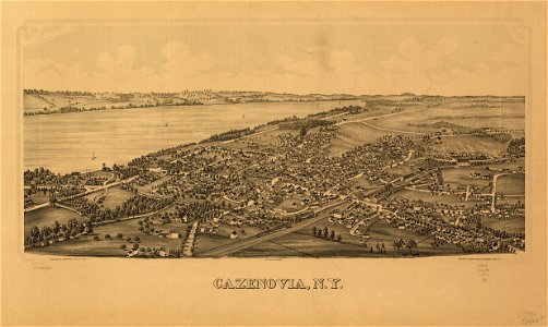
cazenovia
new york
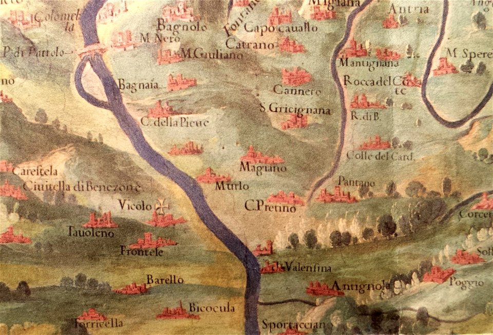
history of perugia
old maps of umbria
maps made in the 17th century
gerard valck
maps made in the 17th century
gerard valck
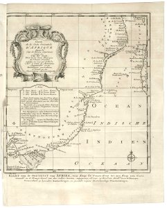
old maps of the dutch east india company - africa
1747)
prints from dankaerts historis at the peace palace library
cornelis danckerts (i)
maps made in the 17th century
gerard valck
maps by willem and johannes blaeu
maps made in the 17th century
maps made in the 17th century
gerard valck
maps with cartouches
netherlands
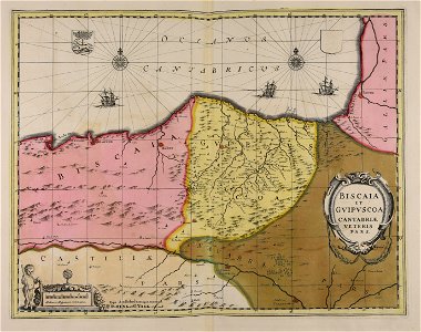
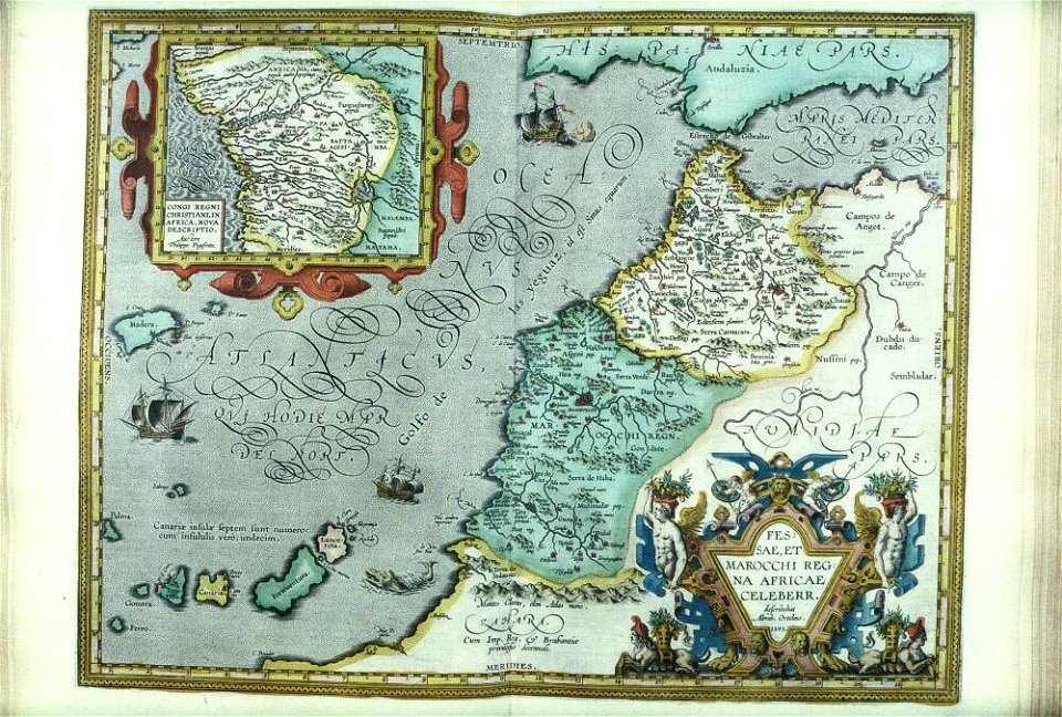
old maps of the iberian peninsula
nicolaes visscher ii
maps of the sea of marmara
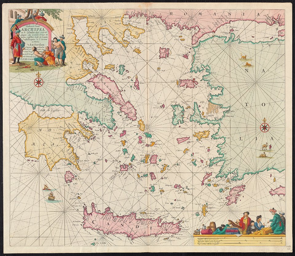
old maps of the aegean sea
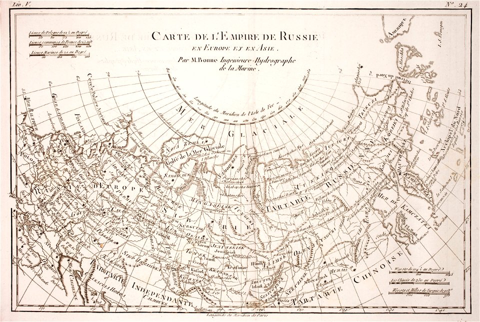
1780 maps of russia
bonne projection
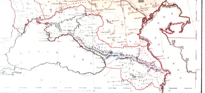
19th-century maps of the caucasus
1856 maps
maps made in the 17th century
gerard valck
maps made in the 17th century
maps by nicolaes visscher i
maps made in the 17th century
gerard valck
maps made in the 17th century
jan janssonius
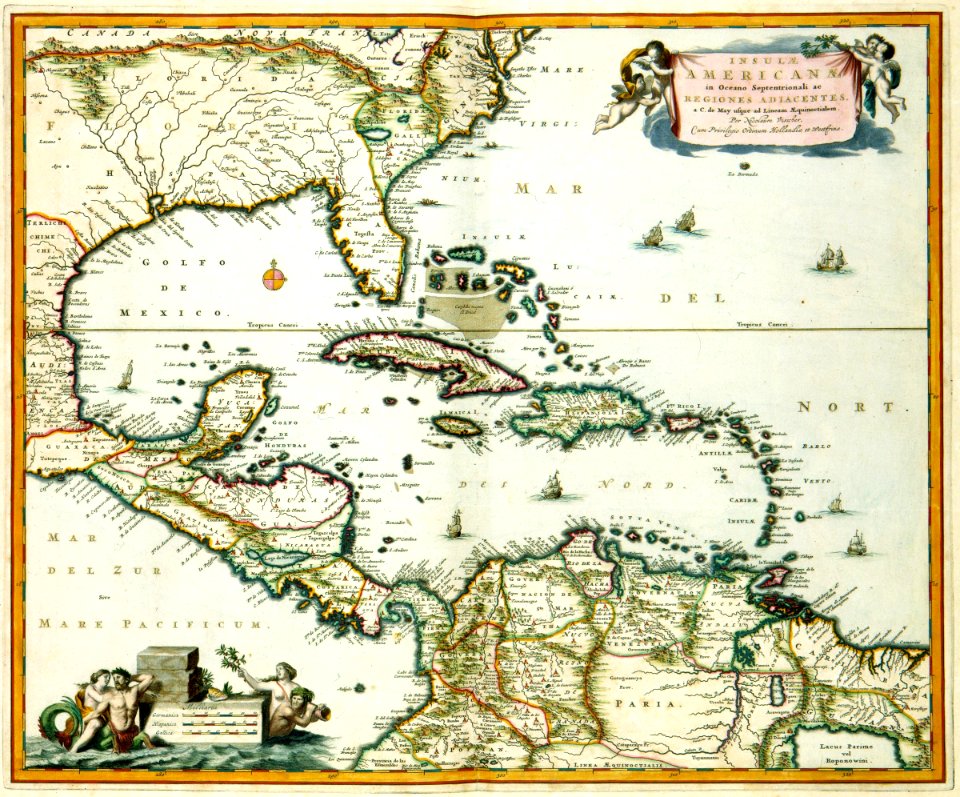
old maps of venezuela
gerard valck
maps made in the 17th century
gerard valck
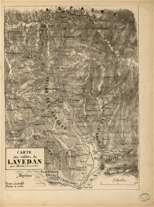
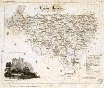
historical images of pyrenees
robert batty (artist)
gerard valck
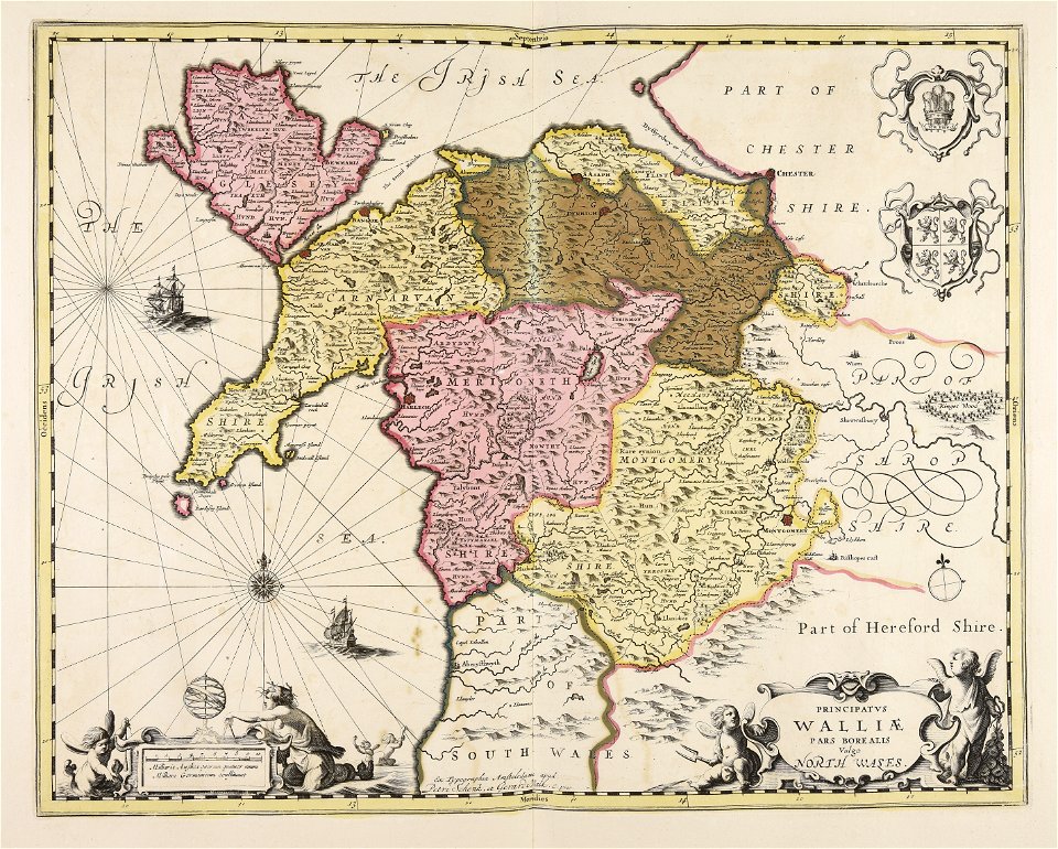
south wales
gerard valck
north wales
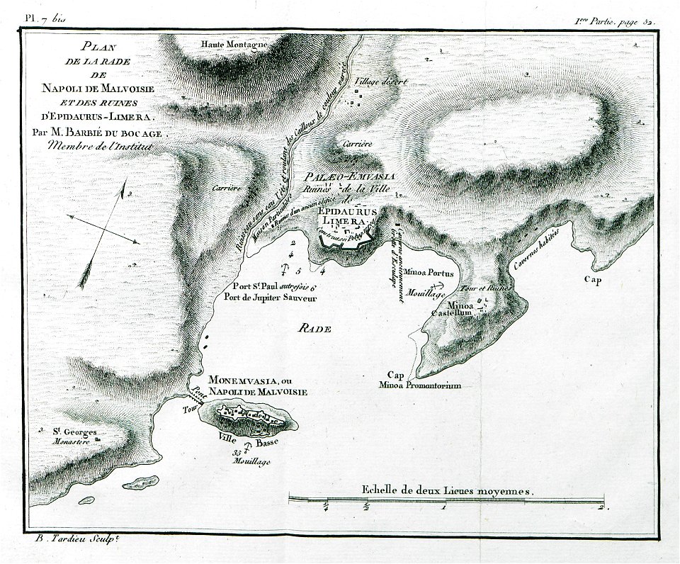
historical images of greece
1808 maps
maps by willem and johannes blaeu
maps made in the 17th century
atlantis magni tomus secundus (biblioteca comunale di trento)
maps made in the 17th century
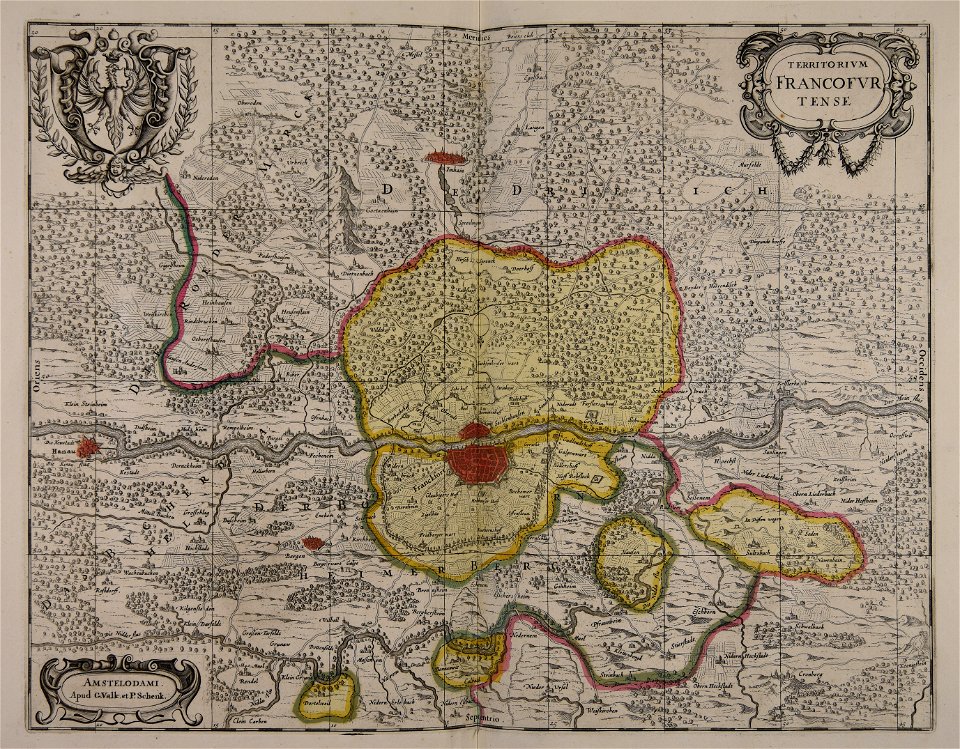
old maps of frankfurt am main
gerard valck
gerard valck
england
maps made in the 17th century
gerard valck
maps made in the 17th century
gerard valck
maps made in the 17th century
gerard valck
university of toronto wenceslas hollar digital collection
hollar maps and plans of london
university of toronto wenceslas hollar digital collection
hollar maps and plans of london
history of leutkirch im allgäu
schloss zeil
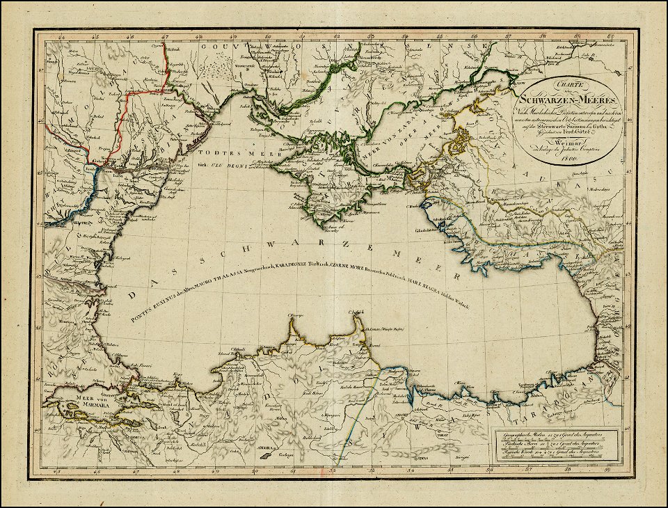
18th-century maps of the black sea
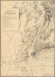
1800 maps of georgia
maps made in the 17th century
old maps of luxembourg
coats of arms of baden-württemberg
1710 maps
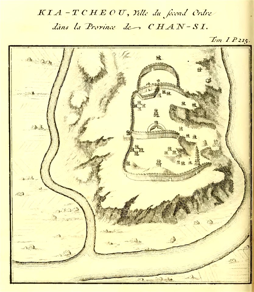
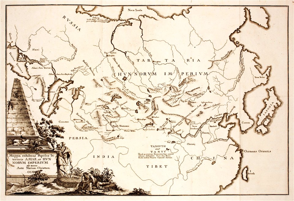
french-language maps of china
shaanxi
prints from the peace palace library
old maps of siberia
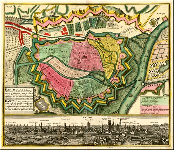
ports and harbours of the polish-lithuanian commonwealth
old maps of gdańsk
fonds ancely - bibliothèque municipale de toulouse - maps
gustave bascle de lagrèze
files from the bodleian libraries
old maps of africa
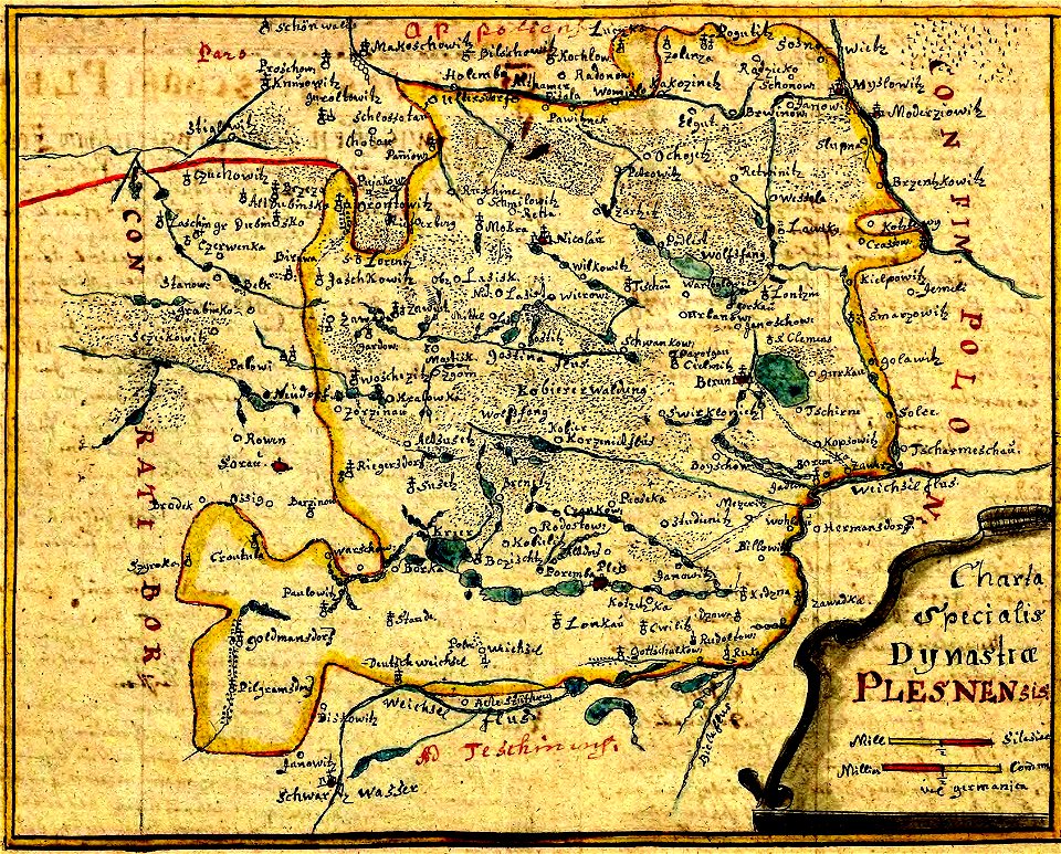
history of pszczyna
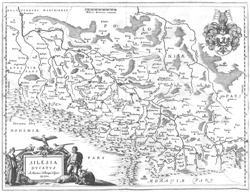
old maps of silesia
engravings of topographia bohemiae moraviae et silesiae
old maps of silesia
new york
camden
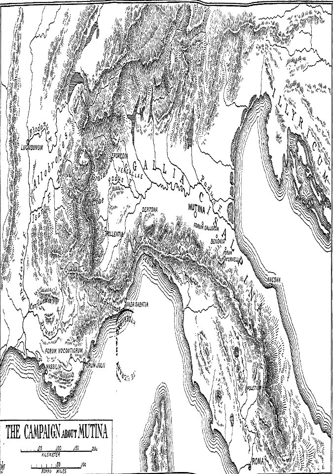
cicero and the fall of the roman republic
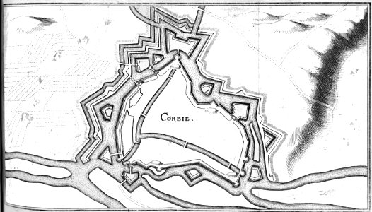
maps of battles
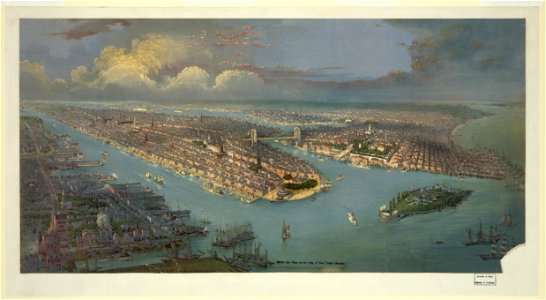
lithographs of new york city
chromolithograph
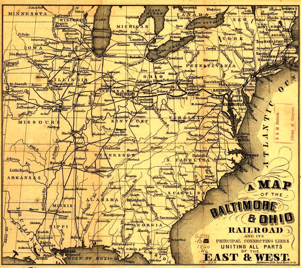
maps in the library of congress
a. hoen & co.
maps in the library of congress
a. hoen & co.
maps and topographical views by joris hoefnagel
engravings in the museum plantin-moretus
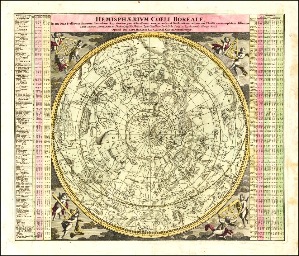
johann gabriel doppelmayr
star location maps
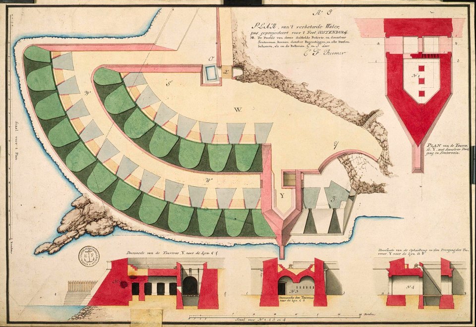
maps of the dutch east india company - sri lanka
maps of fort fredrick
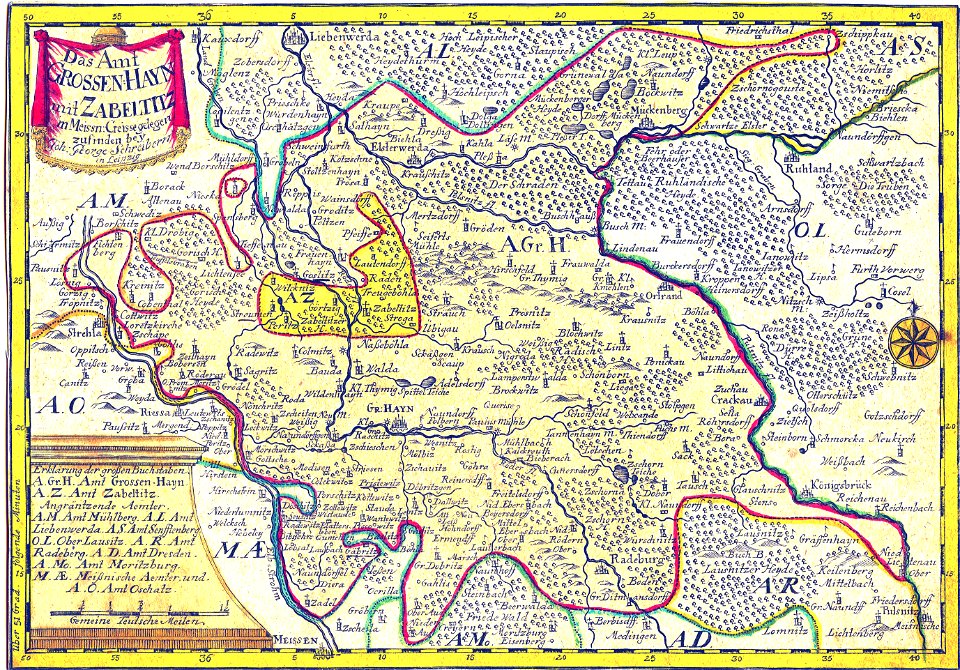
history of lorenzkirch
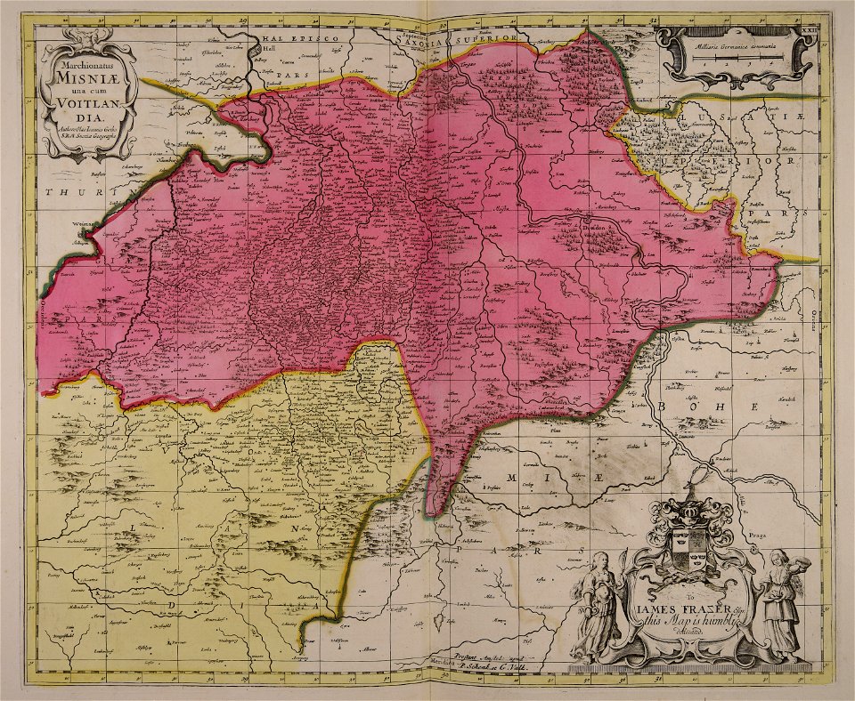
old maps of saxony
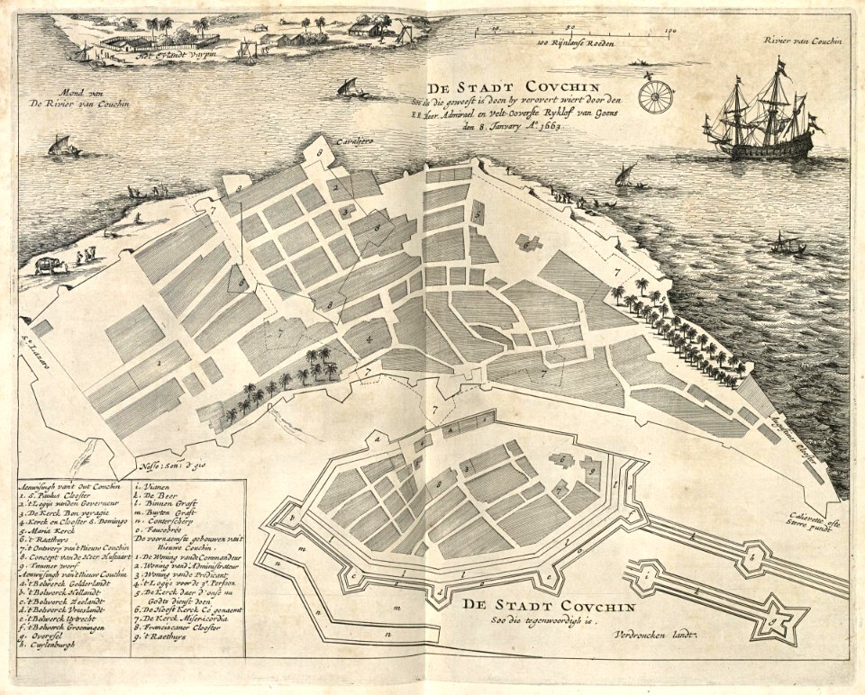
maps of the dutch east india company - india
1672
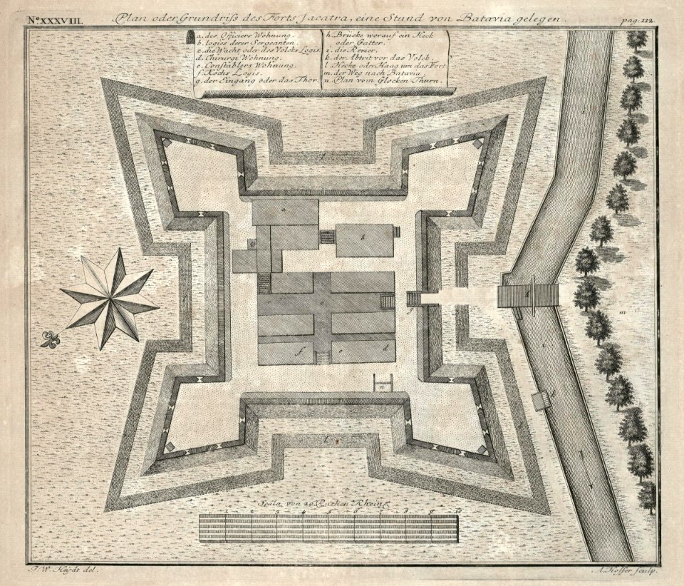
18th-century maps of indonesia
1744
nicolaes visscher ii
1681
windmills in art
bridge of arts
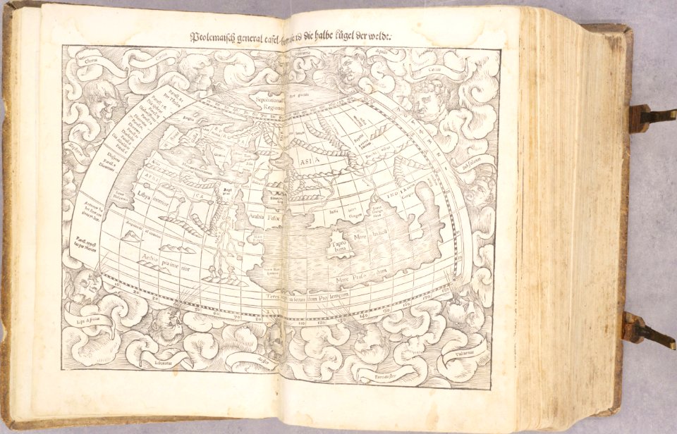
1540s maps of the world
ptolemaic world maps
bibliothèque municipale de reims
rès. g 152
metropolitan improvements (1828) thomas hosmer shepherd
maps from the mechanical curator collection
old maps of rennes
1780 maps
fonds ancely - bibliothèque municipale de toulouse - maps
historical images of pau
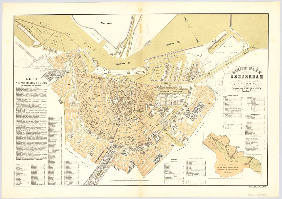
maps in the stadsarchief amsterdam
oosterdok
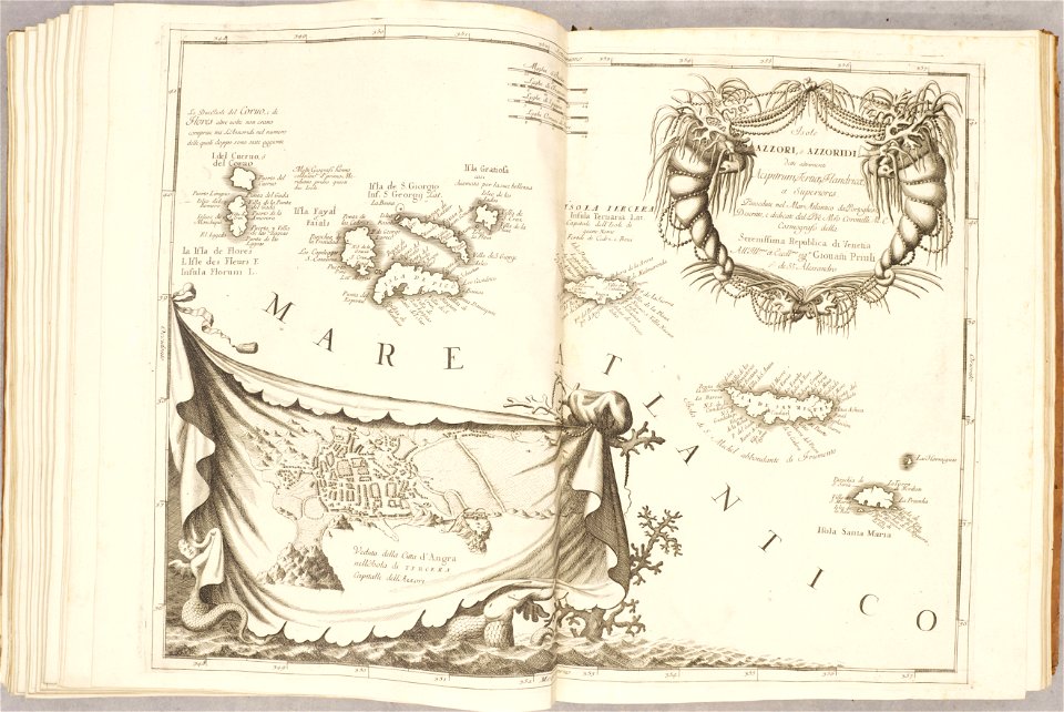
atlante veneto (raremaps.com) volume 2
old maps of the azores
atlante veneto (raremaps.com) volume 2
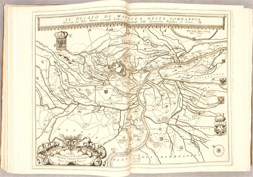
maps of the duchy of mantua
atlas van der hagen
1662 maps
old maps of papua new guinea
maps of german new guinea
charts and maps of the royal museums greenwich
1682 maps
maps by willem and johannes blaeu
copper engraving
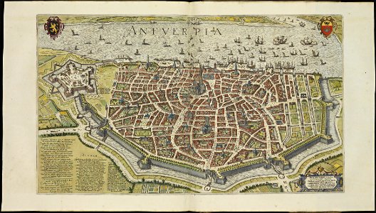
maps of antwerp city walls
frederick de wit
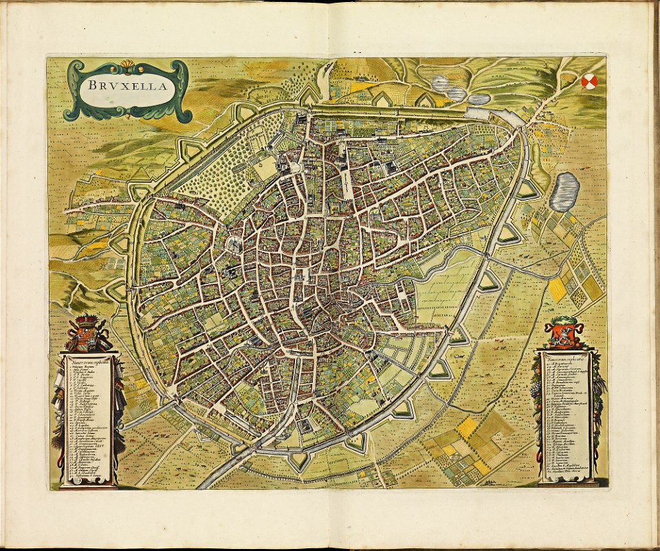
old maps of brussels
frederick de wit
atlas de wit 1698
frederick de wit
maps in the national library of australia
claes jansz. visscher (ii)
old maps of sri lanka
old maps of india
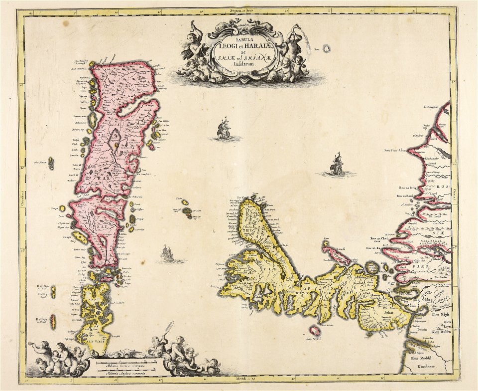
old maps of scandinavia
johannes ratelband
atlas de wit 1698
frederick de wit
maps of antwerp city walls
frederick de wit
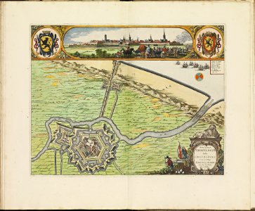
maps of gravelines city wall
frederick de wit
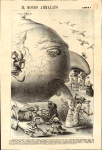
19th-century satirical maps
1870s maps of the world
paintings in the huntington library
vallard atlas
hand-drawn maps and views of world war i battlefields by h.m.
old maps of albania
4801 - 4900 of 33,884
Next page
/ 339